

Businesses » Winterbourne area
We regularly contact the 530 organisations in our Winterbourne guide to keep their details up-to-date.
Click on a category to find businesses serving Winterbourne
C
K
Things to Do
What's coming up in the Winterbourne area?
Be the first to add your event!
Get lots of attention.
Street Map for Winterbourne
The Winterbourne map has been drawn by our talented team at Standbrook Guides. We regularly check and update the map by visiting the area.

Photos around Winterbourne
-
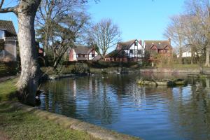
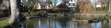
Winterbourne Lake
-
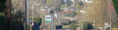
Winterbourne Flaxpits Lane
-
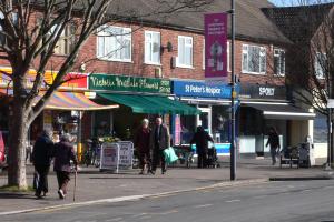
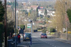
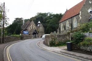
Winterbourne High Street
Photos around Coalpit Heath
-
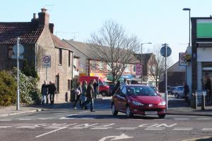
Church Road, Coalpit Heath
-
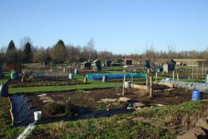
Allotments
-
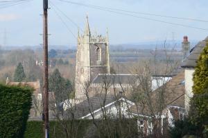
St Peters Church, Coalpit Heath
Photos around Frampton Cotterell
-
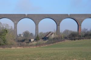
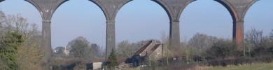
Railway Crossing Framptoon Cotterell
-
All Saints Church
Facts about Winterbourne
Winterbourne, South Gloucestershire is a busy village to the north east of Bristol and separated from the city by the M4 motorway. The village, which is adjacent to the villages of Frampton Cotterell and Coalpit Heath, is just 7 miles from the centre of Bristol and 5 miles from Yate to the North East.
While close to much larger towns the village is surrounded by beautiful countryside and wildlife. The river Frome, with the popular Frome Valley walkway, runs alongside Winterbourne to the east and meanders from Bristol to Yate and beyond.
All the public services are available locally and there are a number of good schools in the area. In Flaxpits Lane there is a bustling shopping centre and there are regular bus services serving the whole of the area with a choice of major shopping centres. Hundreds of local businesses serve Winterbourne and you can find many activities, clubs and organisations including community centres, dancing, football, cricket, rugby and youth clubs, all listed in the Residents' Handbook
| Postcode District | BS36 |
|---|---|
| Dialling Code | 01454 |
| Local MP | Jack Lopresti |
| Nearest A&E | Southmead |
Facts about Coalpit Heath
Coalpit Heath in South Gloucestershire was originally a coal mining village and is situated to the North East of Bristol and separated from the city by the M4 motorway. The village, which is adjacent to the villages of Frampton Cotterell and Winterbourne, is just 9 miles from the centre of Bristol and 3 miles from Yate to the North East.
While close to much larger towns the village is surrounded by beautiful countryside and wildlife. The river Frome, with the popular Frome Valley walkway, runs alongside Coalpit Heath to the west and meanders from Bristol to Yate and beyond.
All the public services are available locally and there are a number of good schools in the area. For shopping there is a small centre in nearby Winterbourne and there are regular bus services serving the whole of the area with a choice of major shopping centres. Hundreds of local businesses serve Coalpit Heath and you can find very many activities, clubs and organisations including community centres, dancing, football, cricket,rugby and youth clubs, all listed in the Residents' Handbook
| Postcode District | BS36 |
|---|---|
| Dialling Code | 01454 |
| Local MP | Luke Hall |
| Nearest A&E | Southmead |
Facts about Frampton Cotterell
Frampton Cotterell, South Gloucestershire is a busy village to the North East of Bristol and separated from the city by the M4 motorway. The village, which is adjacent to the villages of Winterbourne and Coalpit Heath, is just 8 miles from the centre of Bristol and 3 miles from Yate to the North East.
While close to much larger towns, the village is surrounded by beautiful countryside and wildlife. The river Frome, with the popular Frome Valley walkway, runs through Frampton Cotterell and meanders from Bristol to Yate and beyond.
All the public services are available locally and there are a number of good schools in the area. With just a few shops in the village, there are regular bus services serving the whole of the area with a choice of major shopping centres. Hundreds of local businesses serve Winterbourne and you can find very many activities, clubs and organisations including community centres, dancing, football, cricket, rugby and youth clubs, all listed in the Residents' Handbook.
| Postcode District | BS36 |
|---|---|
| Dialling Code | 01454 |
| Local MP | Luke Hall |
| Nearest A&E | Southmead |
Have we made a mistake? If you spot one, please don't hesitate to contact us.