
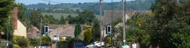
Businesses » Dursley and Wotton U Edge area
We regularly contact the 460 organisations in our Dursley and Wotton U Edge guide to keep their details up-to-date.
Click on a category to find businesses serving Dursley and Wotton U Edge
K
Y
Things to Do
What's coming up in the Dursley and Wotton U Edge area?
Be the first to add your event!
Get lots of attention.
Street maps for where you live
View street maps of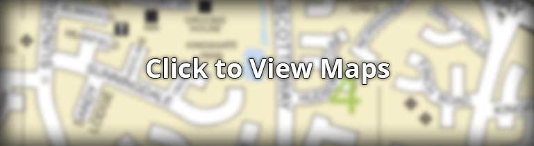
The street maps for the Dursley and Wotton U Edge area have been drawn by our talented team at Standbrook Guides. We regularly check and update the maps by visiting the area.
Photos around Cam
-

Castle Street, Dursley
-
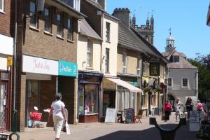
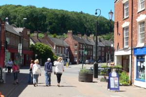
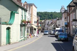
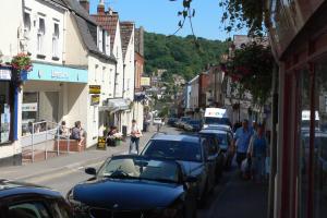
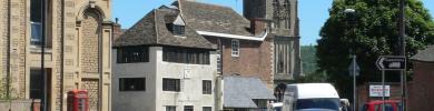
High Street, Dursley
-

Market Hall, Dursley
-

Shopping Centre, Dursley
-

St James Church of England, Dursley
-
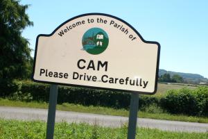
Welcome to Cam sign
Photos around Dursley
-
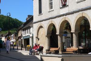
Market Hall, Dursley
-
Castle Street, Dursley
-

High Street, Dursley
-
Shopping Centre, Dursley
-
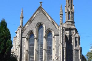
St James Church of England, Dursley
Photos around Wotton under Edge
-
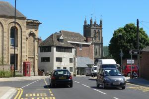
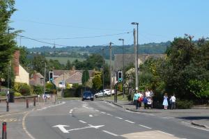
High Street, Wotton Under Edge
-
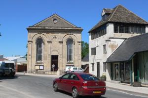
The old Tabernacle Church, now the Auction House, Wotton under edge
-
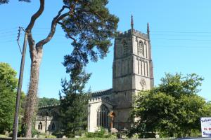
St Mary's Church, Wotton-under-Edge
-
Wotton Shops
-
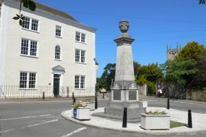
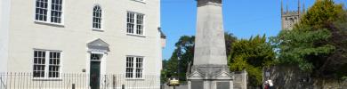
War Memorial Wotton-under-Edge
Photos around Charfield
-
Wooton Road, Charfield
Facts about Cam

Cam, Gloucestershire is a large village adjoining the town of Dursley and just 14 miles South of Gloucester. The village lies close to the M5 motorway, the A38 trunk road and there is a railway station and there are also regular bus services throughout the area.
There are a few shops in Cam and the main shopping centre is very close, in Dursley. There are also hundreds of local businesses listed on this site and offering almost every conceivable service to residents.
All the main public services are available locally with a great number of community activities, clubs and organisations for all age groups. There is a large leisure centre and swimming pool, outdoor sports centre, nearby football, cricket and rugby clubs and community centres. All these details can easily be found within this website under the headings of Public Services, Clubs and Organisations and Local Businesses
| Postcode District | GL11 |
|---|---|
| Dialling Code | 01453 |
| Local MP | David Drew |
| Nearest A&E | Gloucestershire Royal |
Facts about Dursley
Dursley, Gloucestershire is a small town located in the Cotswolds less than 10 miles South West of Stroud and 14 miles South of Gloucester. The town lies close to the M5 motorway, the A38 trunk road and the railway station is just 2 miles from the centreoof town where there are regular bus services throughout the area.
The main shopping centre is in Parsonage Street and Silver Street and there are other options such as Stroud and of course both Gloucester and Cheltenham provide a choice of major shopping centres. There are also hundreds of local businesses listed on this site and offering almost every conceivable service to residents.
All the main public services are available locally with a great number of community activities, clubs and organisations for all age groups. There is a large leisure centre and swimming pool, outdoor sports centre, nearby football, cricket and rugby clubs and community centres. All these details can easily be found within this website under the headings of Public Services, Clubs and Organisations and Local Businesses
| Postcode District | GL11 |
|---|---|
| Dialling Code | 01453 |
| Local MP | David Drew |
| Nearest A&E | Stroud General |
Facts about Wotton under Edge
Wotton-under-Edge, Gloucestershire is a country town located about 5 miles east of the M5 motorway and 5 miles south of Dursley. There are regular local bus services to Dursley, Stroud and Yate and further afield to Bristol, Gloucester and Cheltenham.The main shopping centre is based on the High Street with quite a variety of shops and there are other options such as Stroud (12 miles), Yate (9 miles) and Bristol, Gloucester and Cheltenham provide a choice of major shopping centres. There are also hundreds of local businesses listed on this site and offering almost every conceivable service to residents.
All the main public services are available locally with a great number of community activities, clubs and organisations for all age groups. There is a cinema, an impressive golf course, sports centre and a wide variety of sporting activities. All these details can easily be found within this website under the headings of Public Services, Clubs and Organisations and Local Businesses
| Postcode District | GL12 |
|---|---|
| Dialling Code | 01453 |
| Local MP | Geoffrey Clifton-Brown |
| Nearest A&E | Gloucestershire Royal |
Facts about Charfield
Charfield, South Gloucestershire is a village located about 2.5 miles east of the M5 motorway and 2 mile west of Wotton-under-Edge. Bristol is 19 miles to the south and Gloucester is 21 miles to the north and there are regular bus services throughout thellocal area.
The nearest shopping centre is in Wotton-under-Edge with quite a variety of shops and there are other options such as Thornbury (7 miles) and Yate (8 miles). There are also hundreds of local businesses listed on this site, offering most services to residents.
There is a 9 hole golf course nearby and a number of community activities, and clubs and organisations for all age groups. There is a cinema and sports centre in Wotton and a wide variety of sporting activities from the wider area. All these details can easily be found within this website under the headings of Public Services, Clubs and Organisations and Local Businesses
| Postcode District | GL12 |
|---|---|
| Dialling Code | 01453 |
| Local MP | Luke Hall |
| Nearest A&E | Gloucestershire Royal |
Facts about Berkeley
Berkeley, Gloucestershire is a village nestling between the M5 motorway and the River Severn. Best known for Berkeley Castle, Berkeley is located about 3 miles west of the M5 motorway and 6 miles west of Dursley. Bristol is 21 miles to the south and Gloucester is 16 miles to the north and there are regular bus services throughout the local area.
There are just a few shops in Berkeley and there are larger shopping centres nearby in Dursley, just 6 miles away and Thornbury 7 miles to the south. There are also hundreds of local businesses listed on this site, offering most services to residents.
There are a number of community activities, and clubs and organisations for all age groups plus leisure centres and sports centres within easy reach as well as a wide variety of sporting activities from the wider area. All these details can easily be found within this website under the headings of Public Services, Clubs and Organisations and Local Businesses
| Postcode District | GL13 |
|---|---|
| Dialling Code | 01453 |
| Local MP | David Drew |
| Nearest A&E | Gloucestershire Royal |
Have we made a mistake? If you spot one, please don't hesitate to contact us.